Turkey Run-off Snowshoe
December 27th 2023 10:00am - 2:00pm

Organizer: Karen Martino (Event Director)
Thanks to all who came out to participate in the 2023 Turkey Run-Off. No snowshoeing, but hopefully fun to run on the hard packed trails in Lois Creek and dust off your navigation skills! Thanks also to all the volunteers that worked hard to get this event up and running and of course picking up controls and cleaning the area up afterwards. Thanks to the Friends Of Lois Creek for allowing us to hold the event this year. Happy New Year everyone! Watch for new Ski-orienteering events put on by the Kootenay Orienteering Club in January, February and March at the Kimberley Nordic Centre! See you there.
Solo Winners: David Howe- 42:48, Megan Howe- 64:39, Michel Roberge- 67:52
Team Winners: Ginny Gay and Pete Stepan-55:58, Lois and Jules-73:40, Scott and Daniel Holmes+Anna Ruoss-80:56
Family Winners: Gerry and Carlye Doering-56:46, Erika and Riley Ringseis+Beiley Doering-70:20, Charlie and Hugo-73:28
***Update: Dec. 24th.....With the drastic change in weather and trails now icy and hard packed, Friends of Lois Creek Trails has advised that snowshoes are not needed for our event. Spiked shoes or some type of strap on traction add will be required for sure and snowshoes that have good "claws" might be helpful particularly with hills! Getting down the first hill from Trail Street into the park is the issue as it is quite steep and very icy. Traction aids or snowshoes with good claws will be needed. Also we need to ensure that there is no running on any of the ski tracks that have been set. There will be a path for runners (on the bike/snowshoe trail). Please stay off the cross country tracks.
Hoping to reduce the effects of all that holiday feasting or just want to celebrate winter, then the Turkey Run-Off Snowshoe Orienteering Race is for you. All the action starts at 11:00 AM on Wednesday, December 27th, 2023. On-site check-in and late registration opens at 10:00 am.
Where:
Lois Creek Trail network, Kimberley, BC. Enter from Trail Street.
Format:
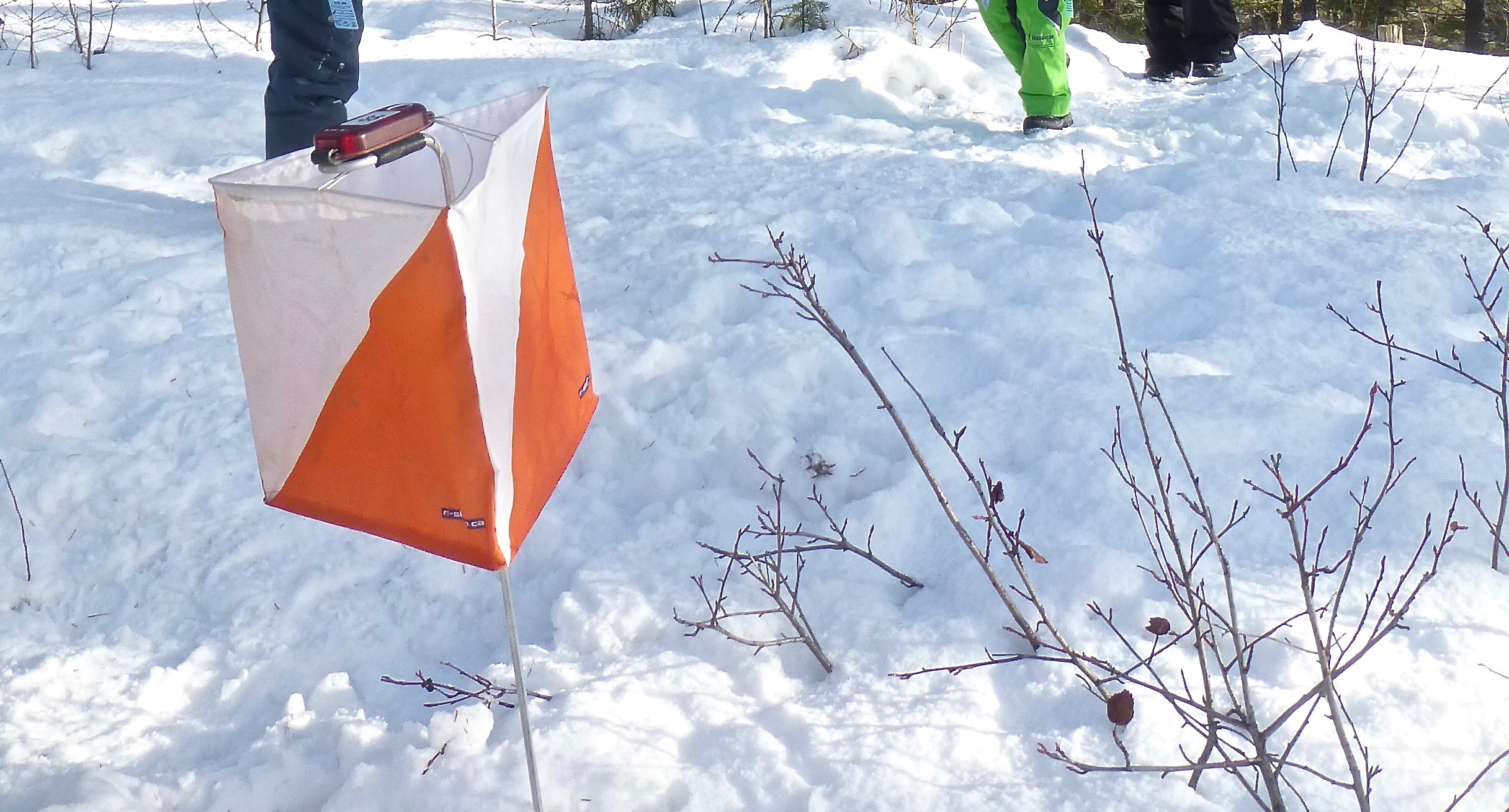
Participants will receive a map of the Lois Creek Trail System. On the map will be marked 13 control points (easily located along the trail system). The goal is to locate as many control points, as you can, in 90 minutes. *You must use snowshoes to protect the Lois Creek Winter Trail system. (Contact organizer Karen Martino, kmartino@telus.net if you want to join the fun but need snowshoes!)
For all you speedsters or experienced orienteers, the Lois Creek map has been updated to include the new trails/features and the course has been set so that you will really have to think and plan to get all of the controls in the time period. Perhaps some "off-trail" navigating will be needed! (wink,wink!)
Map:
Lois Creek Trails Scale 1:10,000 5 m contours
Categories:
- Solo
- Team - 2 to 4 people on the same team
- Family - All members of the same family (Recreational)
- * Junior participants 14 and under must enter on a team or family
Fees (include post event Weiner Roast) :
- $10 per person
- Pre-register by 6:00 pm Dec. 26th. Late fee of $2.00 applies for on the day registrations.
Your entry fee includes:
- Turkey Run-off entry
- Map
- Wiener Roast
- Refreshments
- Awards
- Use of SI Timing stick
Registration:
- Pre-registration is preferred. It speeds things up on the day and ensures we have enough food for everyone.
- Registration check-in and late registration opens at 10:00 am at the Trail Street entrance to Lois Creek
On the Day:
- 10:00 am Registration check-in opens
- 10:30 am Clinic for newbies and first time participants - check-in early
- 10:50 am Registration closes
- 11:00 am Mass start
- 12:30 pm Course Closes - Everyone must be back at the finish. Late penalty applies.
- 12:45 pm Awards
Host: Kootenay Orienteering Club
Registration sign-in at the Trail Street entrance to Lois Creek
Start: Lois Creek - use Trail Street entrance and follow the trail for 300 metres.
We encourage participants to carry a cell phone. Emergency contact number will be printed on your map.